A Circular Walk from Llanrwst, Snowdonia (with autumn photos)
How to Get to Llanrwst
Llanrwst, once famous for wool and harps but now known for its market and tourism, sits at the eastern side of Snowdonia National Park on the Conwy River and A470.
There is a signposted free car park in Llanrwst, a bus service and two train stations: www.carlberry.co.uk/rfnshowl.asp?L1=LLA0370.
There are plenty of well-marked mountain bike trails too.
And Now the Walk from Llanrwst
What to expect: mostly well-marked/worn paths, some steep hills and a few stiles.
Distance: around 14km (8.5 miles).
Disclaimer: I'd always advise you take your own map (e.g. Ordnance Survey OL17). Permitted routes change, and who knows, I may have got some details here wrong!
Llanrwst
The riverside path from the car park to the bridge, Pont Fawr, was closed when I visited, so it gave me the opportunity to walk through the town - head south whichever route you take.
Town square on Bridge Street, Llanrwst (location of the Farmers' Market)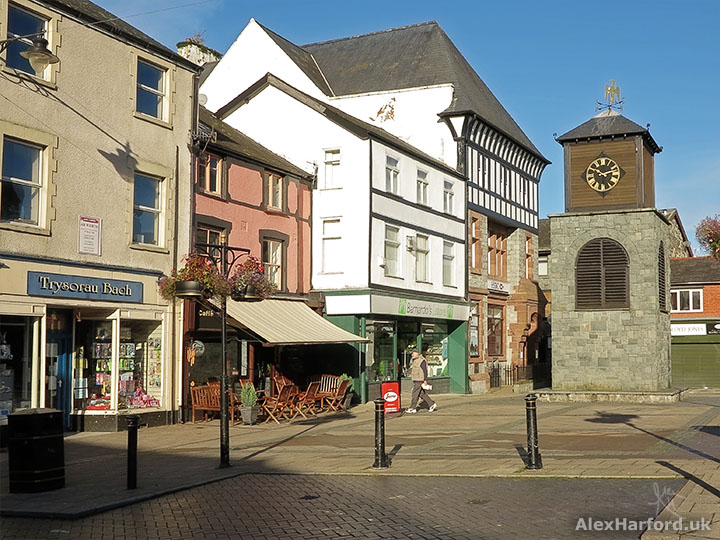
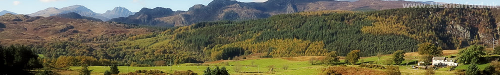
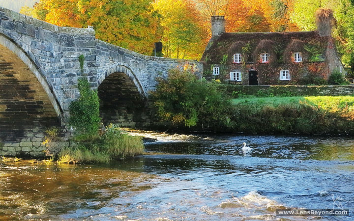
Passing through the town, Bridge Street leads to the 17th-century stone bridge, Pont Fawr, which is two-way despite being wide enough for only one car. Apparently the unwritten rule says whichever driver reaches the brow of the bridge first gets right of way. It's worth stopping at The National Trust's Tu Hwnt Ir Bont Tearooms (pictured at the top of the page, along with Pont Fawr) if you haven't eaten. The walk continues straight past Tu Hwnt Ir Bont, south-west for 400 metres on the B5106. The road leading to Grey Mare's Tail waterfall is up the tree covered hill road ahead. If you fancy a slight detour, Gwydir Castle is to the left at the crossroads. There is a car park near the waterfall if you'd like to miss out this part of the walk.
Looking towards Trefiw from the stile at Grey Mare's Waterfall
Grey Mare's Tail Waterfall
When you reach the next junction (OS Map Reference SH789609), take the road to the right, past Nant Cottage. Grey Mare's Tail is over a stile on the right, just past the house. You'll glimpse the waterfall through the trees. A steep, sometimes muddy path leads down to the base of the falls. What looked like a more friendly path can be taken from the north.
Grey Mare's Waterfall (and that's me, just before I fell backwards into the plunge pool)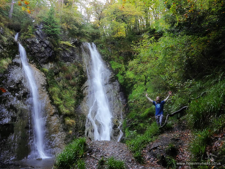
View more photos of Grey Mare's Tail Waterfall.
There's a smaller waterfall a few metres downstream that's worth checking out.
Ruins of Hafna Lead Mine
After the waterfall, return uphill to the stile and Nant Cottage. From here, continue south west along the road (this is the last major bit of road walking) towards the disused Hafna Mine (OS Map: SH780600). This road gets quite steep!
Ruins of Hafna Lead Mine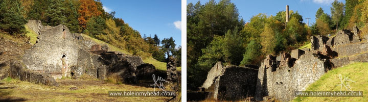
The ruins of Hafna Lead Mine, closed in the 1920s, stand on a steep hillside. Take the path through the ruins towards the west.
Pen-y-Gwaith cottage, Snowdonia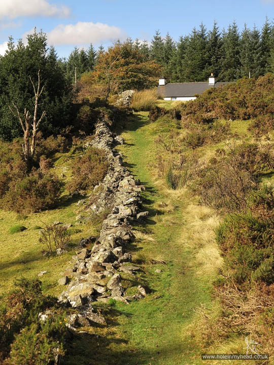
After passing through some woodland, a clearing leads to Pen-y-Gwaith cottage (OS Map: SH777603), which was apparently a training base for Metropolitan Police Cadets in the 1960s. When you reach the cottage continue past its left, eventually heading downhill through more woodland.
Llyn Glangors
Llyn Glangors, with Craig Wen to the right, and Capel Curig (?) to the left in the background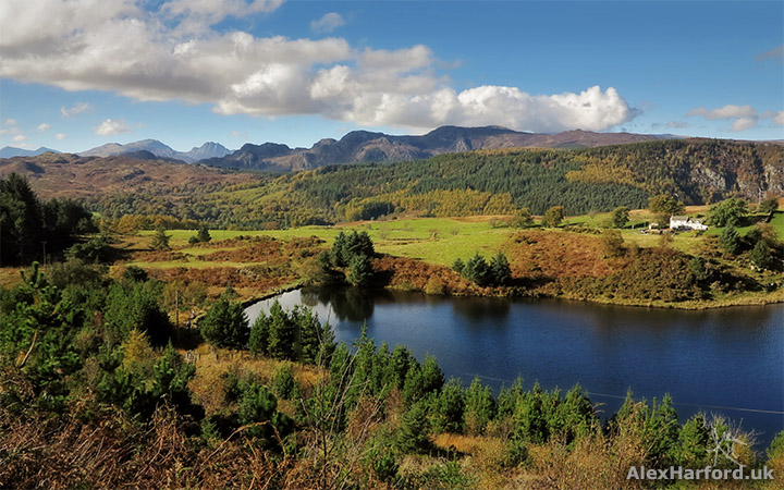
At the base of this section of woodland is a dirt track and a spectacular view that took my breath away (the photo above doesn't do it justice), looking across Snowdonia toward Capel Curig (I think).
Snowdonian mountains, with Craig Wen to the right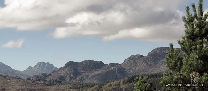
Just across the dirt track the path continues downwards into the valley, past the left-side of the lake, Llyn Glangors (SH772602). Continue to the west past some mine ruins, and look out for an entrance to the forest. It was a warm autumn day when I took the walk, and this is one of those coniferous forests that remains cool and dark on even hot summers days - they provide some great respite against the heat (and rain when it's chucking it down). :D
Llyn Geirionydd, Snowdonia National Park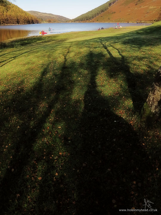
Turn right at the road and go straight ahead when you come to the bend, unless you want to take a look at Llyn Geirionydd (pictured above) from its southern end; only a few metres detour along the road.
Forest near to Llyn Geirionydd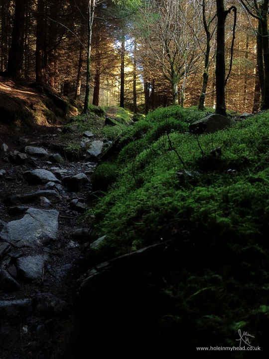 Forest hikers near to Mynydd Deulyn, Snowdonia National Park
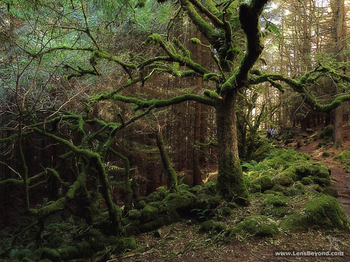
Llyn Crafnant Reservoir
Either way, head to the track near Map reference SH760602 and go left at the fork, eventually heading north west up steep forest tracks, towards Llyn Crafnant Reservoir. The path levels out for a while and then undulates past some beautiful, mossy, intertwining branches, with barely a ray of sunlight penetrating. This is proper British woodland!
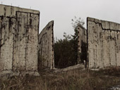
Abandoned church in Cornel, next to Llyn Crafnant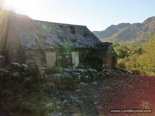
When you come to the stile at the edge of the forest, you can either go over it for views of Craig Wen, or follow the fence to the left to reach an abandoned church (SH749605) and telephone box (I did both). Either way you'll come to the road - head north-north-east alongside Llyn Crafnant Reservoir. There was a guesthouse with a café to the left and someone serving ice-cream at the northern point of the reservoir.
Llyn Crafnant, looking towards Crimpiau, Snowdonia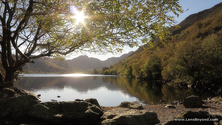
View more Llyn Crafnant Reservoir photos.
Looking down the hanging valley of Afon Crafnant in autumn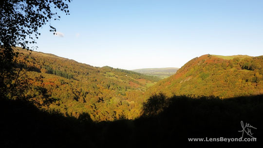
Around 200 metres after passing the northern end of the reservoir you'll come to a path on the right which leads up to the old slate mine, Hafod Arthen. I stopped paying attention to where I was going here, but if you head east you'll eventually come out of the forest near the northern tip of Llyn Geirionydd, a lake you passed at its southern point earlier.
Taliesin monument, northern tip of Llyn Geirionydd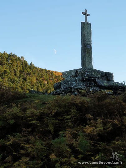
Llanrhychwyn
From the northern point of Llyn Geirionydd turn left onto the road, northwards towards Llanrhychwyn. It bears to the south east after 400 metres and after another 300 metres, where the road beared to the left, I took a signposted path that wasn't marked on my map (there are other marked paths) to Llanrhychwyn church (SH774615), which is reputedly the oldest in Wales. It's also known as Llewelyn's Church. Services are still held occasionally, usually in the summer months.
Llanrhychwyn (AKA Llewelyn's) church, reputedly the oldest in Wales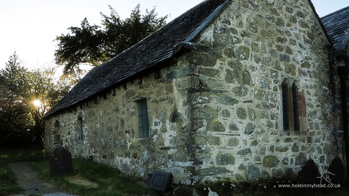
The Home Stretch...
Just behind the northern side of the church, a path runs eastwards for 500 metres to the road that leads to Old Grey Mare's waterfall. If you parked near the waterfall, follow the road south east.
If you're heading back to Llanrwst, the path continues east to the B5106 after about 100 metres of road. If you want to save your legs, buses run via Trefiw to Llanrwst from here (a timetable was posted at the bus stop). Alternatively, turn right onto the B5106 and look for the path on the left back to Llanrwst. The path runs back to Pont Fawr, the bridge in Llanrwst.
I was only joking about every other place name in Wales beginning with double 'L', but maybe I wasn't so far off. Places I visited on this page: Llandudno, Llanrhychwyn, Llanrwst. "Llan" is often associated with saints e.g. Saint Tudno led to the name of Llandudno. The word "Llan" originally meant an enclosure, and later a church parish.
So that is all. Feel free to let me know if you've been on this walk, are going on this walk, and if you notice any inaccuracies/change in routes. Merci Bucketts.
Photos taken with the Canon Powershot G1 X compact camera and OS OL17 map used.


Comments