I spent 3 1/2 months travelling around The Hebrides, taking in 21 islands, with a big chunk of that time spent in the Outer Hebrides, where I visited 12 islands from south to north (in order: Barra, Vatersay, Eriskay, South Uist, Benbecula, North Uist, Vallay, Berneray, Harris and Lewis, Scalpay, Great Bernera, Eilean Chaluim Chille).
29 Photos of Amazing Places in The Outer Hebrides (My Highlights)
The Outer Hebrides are stunning. I was amazed at the diversity of the terrain - each of the main islands (and many of the smaller ones) has it's own character, and I visited numerous places that are as beautiful or spectacular as anywhere I've been.
I expected the Outer Hebrides to be beautiful, but my expectations were surpassed. It's a wonderful place for photography. My trip took much longer than I thought it would, as I found so much to do while passing through (and so much I missed I can return to).
If you're wondering where to visit, I'm sure you'll be inspired by my highlights. They include favourite walks (including loads of great coastal walks), historic buildings, campsites, art galleries and wildlife.
Scenic Hikes with Stunning Views
Tobha Mhor (Howmore), the start and finish-point of a 2-day walk taking in Hecla, Beinn Choradail and Beinn Mhor, the 3 mountains in the background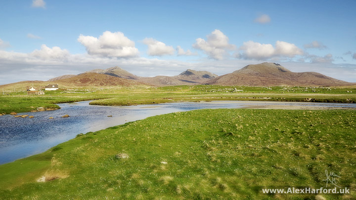
I love the outdoors and walking is often the best way to get to know a place, whether it's a city or the countryside. There are amazingly scenic drives in the Outer Hebrides, and I enjoyed cycling (with no back brake for most of the trip, until I got it fixed in Stornoway in the north). But you're sealed off from everything in a car, and pass by too fast. Usually cycling is my favourite way to see places, but some walks I did were so fantastic, walking pace was the only way to take it all in.
Gleann Heileasdail, looking towards the Isles of Canna and Rum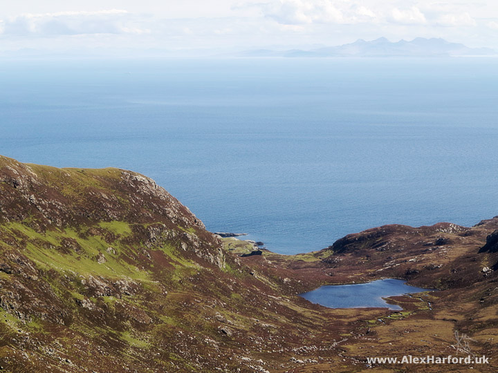
I expected walking to be a highlight (it's one of the main reasons I travelled to The Hebrides), but I didn't expect such a walkers paradise.
Hecla and Beinn Choradail from the approach to Beinn Mhor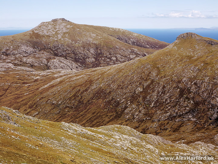
One day I could be walking in challenging, rocky and varied terrain, with ever-changing scenery and spectacular views, and another I could be taking the most relaxing stroll ever, along white sandy beaches with warm blue skies; the smell of wildflowers on the gentle breeze and bird-life everywhere. Or both in one day with the numerous beautiful beaches backed by hills and mountains, particularly in Harris.
Beinn Mhor's summit ridge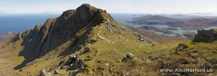
If it went completely dark, I didn't see it (I was in the Outer Hebrides from mid-May until early-July - usually asleep before 1am). So as long as I carried a tent and enough food, I didn't worry about finishing a walk at any particular time, or even worry about returning late if I didn't take a tent or bivvy. Sometimes I found myself walking to just another beach, or just over another hill, until close to midnight, without my tent. It made me tired and 11:30pm became an early night for sleep, but it was a joy to be in such peaceful places so late at night. The lack of true darkness was a slight disappointment however, as with the almost complete lack of light pollution, I was looking forward to some starscapes.
As well as wild camping spots, excellent campsites are evenly spread throughout the islands. My favourite was the campsite at Borve on the Isle of Barra, which claims to be the furthest west campsite in Britain.
Traigh Ear beach on the Udal Peninsula, North Uist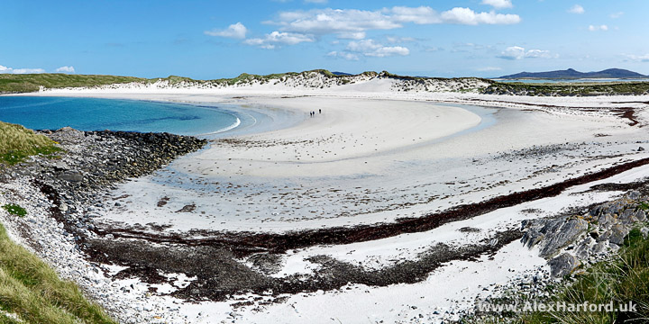
Many places seem untouched by humans, and the islands are so peaceful. Just don't sit in an oystercatcher's territory - you'll know if they start meep meeping while flying around you in circles.
Although I walked to the highest summits on most islands (I failed to scale the lowest of them all - that's a story for another time), there are loads of small hills with great views too.
Numerous beaches in view from Ceapabhal, near to Northton, Harris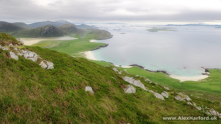
All of this, and I haven't mentioned I often went more than a day without seeing another person. When I did see other people, whether it was a local or fellow traveller, we'd often stop to chat. I probably met more German people than any nationality outside of Scottish, lots of geologists, and even a German geologist at the top of a mountain - the only person I saw on that mountain (though that was the Isle of Rum, so not The Outer Hebrides).
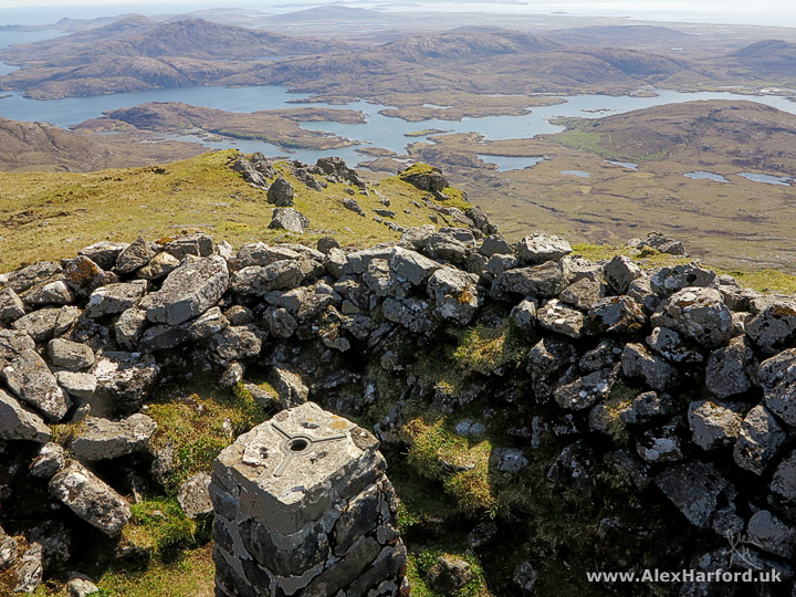
Looking over Glen Cravadale from near to the Huiseabhal Mhòr summit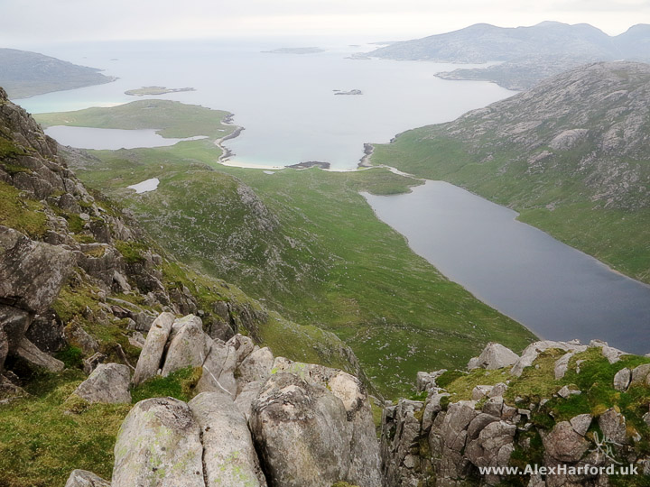
There must be a downside to all this walking outdoors?
It's Scotland. How about the midges and bogs and tics and terrible weather?
Midges only bothered me twice, and only briefly as I started walking again (they can't keep up - I've no idea where they appear from when you stop), and there was usually enough of a breeze to keep them away.
I only had to remove 3 tics on the whole trip, and that was when I wore a short-sleeved shirt. Covering up seemed to do the job.
I was lucky with the weather - I heard one local on the Isle of Berneray say it was the driest spell for over 10 years. It was dry for so long that even large stretches of boggy land were dry, which helped make my walks more enjoyable. I still managed to go shin-deep into a small bog near South Uist's highest point when I wasn't paying enough attention, and cycle into one on the Isle of Lewis (there had been rain by that point). I sort-of enjoyed the bike crash as it was a soft landing and an amazing location for it.
Hiking Highlights in the Outer Hebrides
The photos above and just below are from my favourite walks, 3 of 4 from Peter Edwards' The Hebrides: 50 Walking and Backpacking Routes:
Day 2 of Walk 37: Hecla, Beinn Mhòr and South Uist's wild east coast - a good mix of terrain, spectacular views in every direction, and a nice challenge early on in my trip. Also the first time I used a walking pole (after almost leaving it at Uisinis Bothy - luckily I was only 10-minutes away when I realised), and my legs were happy for less exertion.
Walk 39: Around the Udal Peninsula, North Uist - beautiful beaches, lots of bird life, complete and utter bliss (of course the weather helped in that sense).
Walk 44: Huiseabhal Mhòr, Oireabhal and Huiseabhal Beag, Harris - almost a combination of Walks 37 and 39, with beautiful beaches and excellent mountains with great views.
My favourite two walks by far were the two in The Uists; both pretty much how I imagined a perfect day in the Hebrides.
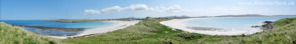
18 photos stitched together to show the Traigh Ira and Traigh Ear beaches on the Udal Peninsula, North Uist (Walk 39)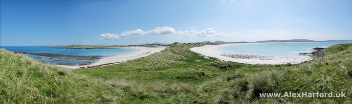
The walk I enjoyed most that wasn't in Peter's guide looked interesting when I opened my OS map after arriving by ferry at Leverburgh in Harris - beaches galore from Northton to Rubha an Teampaill (beaches on the way pictured below). And up to Ceapabhal's summit for a view over them all, with more mountains, beaches and islands in every other direction - including the St Kilda archipelago, the remotest part of the British Isles.
Wandering around beaches near to Rubha an Teampaill after 11pm, Harris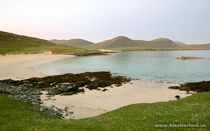
I e-mailed Peter to tell him how great the 50 Walks book is, and how it contributed to such an amazing trip. He was kind enough to share his highlight of the Outer Hebrides:
"The Uig Hills and coast of southwest Lewis are my highlight of the Outer Hebrides. These are wild and rugged hills with astonishing views and the coastline at the southern extremity of the peninsula has a magnificently remote atmosphere."
So we both share the Uig Hills as a highlight. I agree they feel like the middle of nowhere. Some of the coastline Peter mentions is pictured below.
Just to be serious for a moment and help anyone on their way to the Outer Hebrides; there were a couple of days when I wouldn't have liked to be up in the hills and mountains. I used a combination of www.xcweather.co.uk (recommended by numerous locals, and much more accurate than the MET Office/BBC based on my experience) and www.mwis.org.uk to make decisions based on the weather.
Another "walker's paradise" thing I've just remembered (though it depends on your point-of-view whether it's a good thing) - there was hardly a sign of a path for many of my walks. It scared me a bit before I went but I actually loved the freedom of wandering wherever I felt like, and found it easier to navigate in a way - as I concentrated on aiming for landmarks and looked at maps in more detail, rather than relying more on a worn track. I always use OS maps.
More Beautiful Beaches
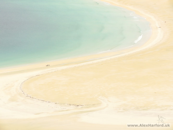
Scarista, Harris, viewed from Ceapabhal(as mentioned in favourite walks above)
It didn't take much time in the Outer Hebrides to conclude that ridiculously beautiful beaches should be copyright Scotland. This is still outdoors, but an excuse to show more photos of Outer Hebridean beaches. Many are accessible without strenuous hiking. Here are some favourite photos I've quickly chosen. There are tens (maybe hundreds?) that are just as beautiful.
Isle of Berneray's west coast, which is pretty much all beach, at over 3 miles long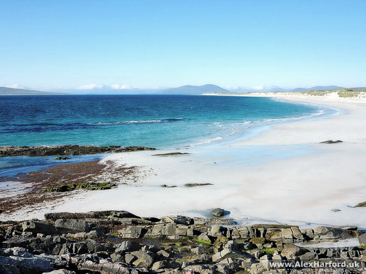
Some beaches look incredible whether they're backed by clear blue or dark shades of grey. Somehow I managed to avoid the infamous Hebridean weather until 2 months into my trip. But even when that soaked me through (making me realise my waterproof trousers were no longer waterproof, so using Post Restante for the first time for a replacement) and almost blew me off my feet, I still thoroughly enjoyed the views and the experience. I know that would have been different if I was up a mountain, but I was here - I didn't stray too close to those cliff edges in the background:
Mangersta beach at high tide, Lewis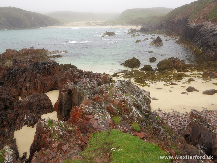
It's impossible to pick a favourite beach, but for the sheer number of beautiful beaches in a small location, I absolutely loved the Udal Peninsula on North Uist, and the area around Mangersta, Carnish and Timsgarry in southwest Lewis.
Traigh Mheilein beach, Harris(part of Walk 44, mentioned as a favourite walk above)
Art Gallery Highlights
The galleries on the Outer Hebrides were inspirational. Some are in cafés or specific gallery buildings, but often artists use a room of their home for people to visit. I didn't know about the galleries before my trip, and it's now something I'd love to do myself one day.
There's sculpture, photography, weaving, craft, painting and probably many other art-forms I've missed. Outer Hebrides photography and other art featured heavily.
Willie and Moira Fulton's Gallery, Drinishader, Harris
This gallery gave a good impression before I got there. There aren't many trees in the Outer Hebrides, but there are hundreds here (Willie planted them himself) and the "Engage 1st gear, then turn left" sign was useful - I remember thinking "yeah, whatever", but paid attention to the sign anyway and was glad I did, for the short but very steep hill.
Drinishader bay - I didn't realise when I took this photo, but that building is the gallery
I've always appreciated various art forms but have never had much knowledge about the history of famous artists. One painter that stood out when I was a child (who still does) was Turner. I love the atmosphere in some of his paintings, and the amazing skies and seascapes.
When I saw Willie Fulton's paintings on the gallery wall I was blown away by the incredible beauty and atmosphere, and I thought of Turner. Photography has become my visual medium, but these paintings do things I've never seen a photograph do. I may be talking rubbish, but maybe one reason I was moved by Willie's paintings was because they bridge the gap between a Turner and a photograph. Turner's paintings usually look like a painting however you view them, but there's more reality to Willie's paintings. I felt I could be there, taking in the view, the feelings and atmosphere myself.
As well as the stunning land and seascapes, there are the best paintings of sheep I've seen, managing to look endearing and slightly sinister at the same time.
Moira Fulton's paintings are a great contrast too - often focusing on the brighter side of life on the Outer Hebrides, and both artists combine to make a must-visit gallery.
Inside Willie and Moira Fulton's gallery - my favourite paintings were on the opposite wall, but this is the better photo!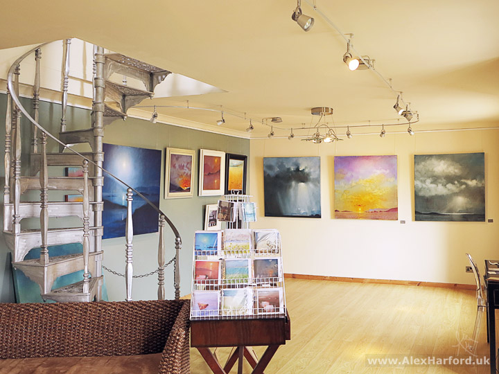
The gallery in Drinishader is a lovely space, and it was great to chat to both artists. Willie built the road to the building himself (I wonder if he gets fed up of telling visitors the same thing over and again?). As for Willie's highlight of the Outer Hebrides: "After 40 years living and painting on the Isle of Harris I'm beginning to understand some of the mystery and spirituality of this very special place."
Brian Melton's Gallery, Bunavoneader, Harris
When I first arrived at Brian's gallery, he wasn't around. So I returned after climbing the nearby An Cliseam, the highest Outer Hebridean mountain (799m). He still wasn't around, but luckily a neighbour spotted me and let me in.
It was more than worth the return visit. Brian paints with beeswax, and if that sounds like a gimmick, it certainly isn't. Brian originally tried beeswax painting as a break from his commercial work, and whether the medium is beeswax or not, the paintings are beautiful. The colours he uses, and the different textures he creates with his strokes, are wonderful. He writes on his website that painting with beeswax "is one of the earliest forms of graphic art known to man. Developed by the ancient Hellenistic Greeks more than 2,000 years ago and soon practised by the Romans and Egyptians."
Some layers are partly transparent, and the beeswax has a character of it's own I can't really describe. I wish I was at the gallery now so I could try to better put it into words. The originals have to be seen to be fully appreciated (as is the case with most paintings, but even more so here).
Inside Brian Melton's gallery - a small selection of the paintings on display (these are of St Kilda)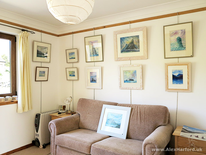
The technique Brian uses is called impasto. "I lay wax glazes by using hot palette knives, irons, soldering irons and any other implements that can be heated up, to give various textures and effects. Hot air guns are then used to burn-in the final rendering."
Brian's highlight of living in the Outer Hebrides? He loves the ancient landscapes (that also explains why I saw so many geologists here): "It's contours and designs and textures. The hills are sculptures - the lakes, rivers (and now roads) draw up unique patterns mapping out fascinating landscapes."
Both Brian Melton and Willie Fulton (I'm not sure about Moira) moved to the Outer Hebrides from the UK mainland. After only 2 months there, I see the appeal from both their perspectives.
Best Historic/Reconstructed Buildings
The Outer Hebrides has a load of brilliant buildings and museums that show off the islands' cultural heritage.
There are many places worth visiting I haven't mentioned below, including Shawbost Norse mill and kiln (Lewis), Barpa Langass chambered cairn (North Uist) and the nearly 5,000-year-old famous Callanish standing stones (Lewis), which I happened to be at on Summer Solstice without realising. "Is it always this busy?" I thought. The short boat trip to Kisimul Castle (Barra) is good fun too.
Gearrannan Blackhouse Village, West Lewis
Blackhouses are a traditional house that were common across the Hebrides. People and animals (such as cows) shared the same building (separate ends, with a partition between), helping keep them all warm in winter.
The main living room in the restored Gearrannan blackhouse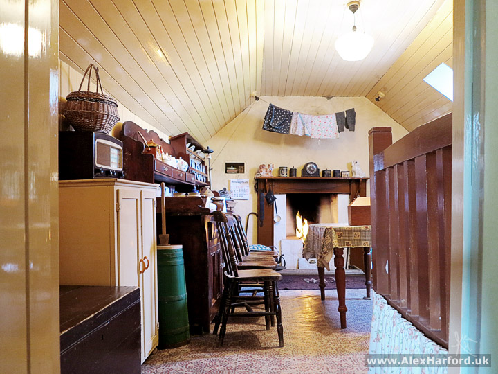
The last living blackhouse village in the Outer Hebrides was Gearrannan, which after a decline lasting around 70 years, was finally abandoned in 1974. Due to the nature of the materials used (wooden timbered roof covered with turf) and the savage Hebridean weather at times, the houses quickly fell into disrepair.
Luckily their importance was realised, and they were declared a conservation area two years after the last residents left. Eventually The Gearrannan Trust was set up to restore the village and help preserve the centuries-old way of life that almost disappeared.
There are various explanations of where the name "blackhouse" came from. The one I saw most often is that in the late-19th century, houses began to be built with new lime-mortared walls, and as they were much lighter in colour than the existing houses, they became known as "white houses", and the old houses became "blackhouses."
I can't remember where, but one definition I read stated they were called blackhouses due to the black coating on the inside from the constant burning peat fire.
There are many examples across the Hebrides where the blackhouse ruin stands next to the newer white house. If I remember rightly, the exterior difference was the reason given at Gearrannan and the Arnol Blackhouse, so you can't get more authoritative than that.
One thing I loved about the Gearrannan Blackhouse Village is that there are no labels, signs or fences in the rooms or unlikely places, making the whole feeling more authentic. It helps for photos too. The information is saved for a separate building.
Info board in the museum building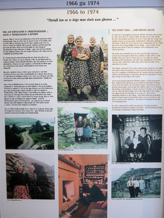
It felt like stepping back in time, and there was even a Harris Tweed weaver in one room.
Weaving (at home) and fishing were two popular occupations during the time of the blackhouses. Since 1993, Harris Tweed has been protected by the Harris Tweed Act. One condition is the tweed must be woven by islanders at their home in the Outer Hebrides.
Harris Tweed weaver at a loom inside the blackhouse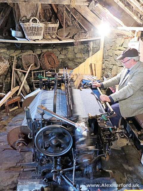
Dun Carloway, West Lewis
Around 2,000 years old, Dun Carloway broch didn't look like much from the pictures I'd seen, but appearances can be deceptive. I enjoyed clambering and ducking around the structure, and squeezing between it's narrow walls.
Outer entrance to Dun Carloway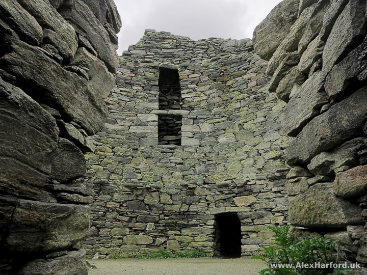
"Dun" is a word meaning fort, and so is "broch" - "a circular stone tower built around the beginning of the Christian era, having an inner and an outer wall" according to dictionary.com, and unique to Scotland.
Despite these definitions, many archaeologists disagree they were intended to be purely defensive. The Historic Scotland information panel at the broch itself says "Probably built to reflect the prestige and status of their inhabitants, brochs were primarily dwelling-places for the principal family in the area. They would have provided some protection against sporadic raiding, but were not purely defensive structures."
There is a great little museum about the history of brochs and the area, which I wasn't aware of before my visit.
Iron Age Building, Great Bernera
This reconstructed Iron Age building is in an incredible location by the coast, with a nice bit of symmetry provided by the beach and neighbouring cemetery when viewed from the hill behind.
Looking over Bostadh's Iron Age building, beach and cemetery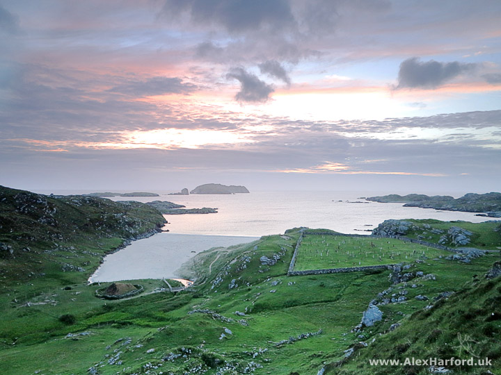
In 1993, a huge winter storm uncovered a few Iron Age buildings, some almost completely intact. After excavation, they're now covered in sand again, but a reconstruction was built in a safer location.
Reconstructed Iron Age building - see how they were built to be "sunken" below ground level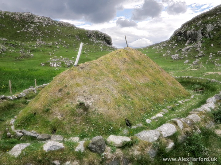
The building's inside was atmospheric and the local volunteer was brilliantly informative. I love how she does her own experiments to figure out what life was like. For example, figuring out the best place for the fire (for warmth and drawing the smoke through the chimney) and the warmest place to sit in the building. I was surprised when I asked if she'd been interested in the Iron Age before the building was uncovered, that she hadn't, so she's built up a great knowledge and passion for the era since.
If you're on your way here, check the opening times, as they were shorter than most places I visited.
The Birds!
I knew I'd see lots of Outer Hebridean wildlife. I usually use a compact camera with a small zoom, so before the trip I bought a superzoom camera especially for the wildlife. And it's good to have a spare camera for such a long trip - I almost drove over my main camera, and it just about survived.
Oystercatchers on the Udal Peninsula, Isle of North Uist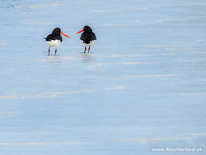
Before I went to the Hebrides, I didn't know the difference between a seagull, kittiwake or fulmar. I probably assumed they were all gulls of varying sizes (the fulmar isn't - it's related to the albatross). I like to know what I'm taking photos of, so I started by googling the ubiquitous "black and white bird long orange beak hebrides" to find the oystercatcher, which I felt like I should've known given the long, thin beak.
I learnt other birds as I went along, mostly from people I met along the way.
Juvenile peregrine falcon, Lewis. This was 5 metres away from me on a cliff edge - we were as shocked as each other and it flew off straight away, to be joined by another peregrine falcon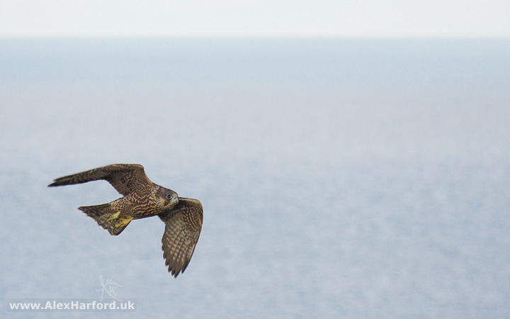 Oystercatchers on the Isle of Scalpay.
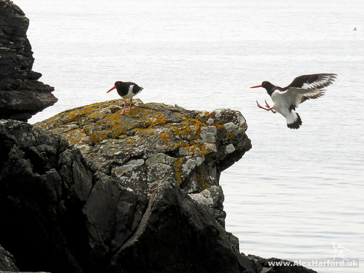
I stood and waited around 1/2 an hour to get this shot (patient for me when it comes to photography). The oystercatchers kept flying to the rock, so I focused on it and waited
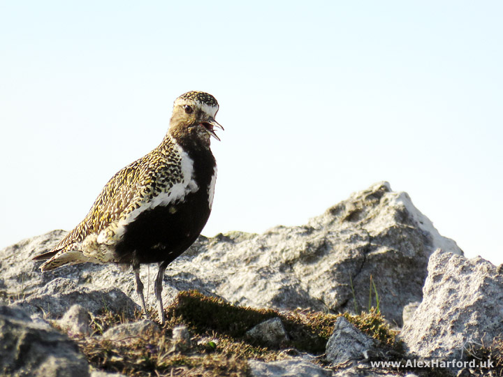
 Golden plover in summer plumage near to Roineabhal summit, Harris.
This one followed me uphill for a while, though it probably thought I was following it, as it kept flying slightly in front of me
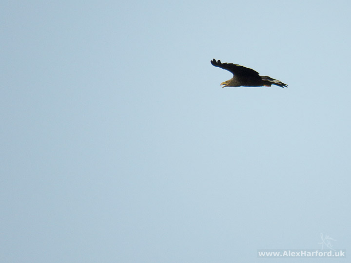
I saw a few sea (AKA white-tailed) eagles throughout the Hebrides. Despite it being one of the largest birds of prey in the world, my superzoom camera struggled to focus on them. My best photo of a sea eagle is from the Isle of Mull, but it had a large tag on it, and anyway, Mull isn't part of the Outer Hebrides, so as that would be cheating for this article, here's a heavily sharpened out-of-focus photo:
Sea (AKA white-tailed) eagle, South Uist.There were at least 3 (I couldn't tell if the fourth was a sea eagle) flying around - it was amazing to watch them for at least 20 minutes until they disappeared further out to sea
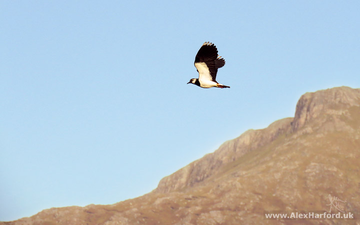
 Lapwing, with Beinn Corradail in the background, Isle of South Uist.
Lapwings usually seemed to be struggling to fly against a headwind, even if there wasn't one. They made a sound like a malfunctioning police car. This was at the end of one of my favourite walks mentioned above - I'd climbed the mountain in the background earlier in the day, and just as I was looking forward to reaching my car for food, a few lapwings appeared to tease me. Eventually I captured a couple of decent photos, and when I got back to my car, a Double Decker had never tasted so good
That was my highlights of the Outer Hebrides
So quite conveniently, my favourite walks were in The Uists, my favourite galleries Harris, favourite other tourist things (i.e. buildings) Lewis, and favourite wildlife and beaches everywhere!
It was easily the longest continuous trip I've taken, and I think the key to enjoying it so much was the variation. If I'd walked every day, for example, it probably would have lost it's charm a bit. It was great to be able to mix things up. Even sitting on a beach for an afternoon or evening made a nice change, as I'm not usually a beach holiday kind of person.
I have much more to come from my trip around the Outer and Inner Hebrides, and out to St Kilda, so feel free to sign up to my mailing list or like my Facebook page if you'd like to know when it appears. I haven't got around to sending a mailing list e-mail yet, and when I do get around to it, it'll only be once every other month...
What are your highlights of the Outer Hebrides if you've been? What would you look forward to most if you haven't? Have I convinced you to visit? Do you have a favourite photo? Comment below. :-)
It'd be great if you shared this (I lost thousands of shares after migrating from lensbeyond.com to alexharford.uk). Feel free to get in touch if you have any questions I might be able to answer.
You may like
Azores: Best Photography Spots by Island The Azores has a wealth of breathtakingly beautiful scenery. If you only have a short time on an island, these are the photo spots I recommend
Photos of Sgùrr Alasdair and Eas Mòr (Circular Walk from Glen Brittle) Scrambling up the highest island mountain in the UK and marvelling at one of the most picturesque waterfalls I've seen (Isle of Skye)
Sgurr na Stri Circular Photo Hike from Camasunary (Skye) A wonderful walk on the Isle of Skye with amazing mountain views, red deer and The Bad Step
Isle of Arran, Scotland Despite its small size, at 19 miles long and 10 miles wide, Arran has a diverse landscape and is often known as 'Scotland in Miniature'
Or, see more photos and articles from Scotland
Win a print from this page! All UK residents on my mailing list eligible.


Comments